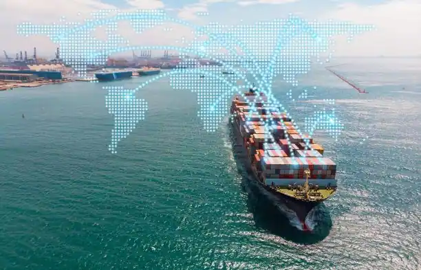
A vessel tracking service gives shipping professionals access to current and historical information about ship movements across ports, oceans, canals, anchorages, and trade routes. By combining Automatic Identification System data, satellite coverage, vessel databases, and port intelligence, these services help users understand where vessels are, how they are moving, and what their activity may mean.
For charterers, shipowners, operators, traders, brokers, logistics teams, and maritime analysts, vessel visibility supports faster commercial and operational decisions. It can help identify available tonnage, monitor voyage progress, assess congestion, estimate arrival times, and detect changes in vessel behaviour.
Tracking information also provides context around the wider shipping market. A growing number of vessels waiting outside a port can indicate congestion. Changes in vessel speed or routing may signal weather disruption, updated orders, or operational difficulties. Shifts in fleet deployment can reveal developing cargo demand across particular regions.
As shipping markets become more volatile and data-driven, reliable vessel tracking has become an important part of everyday maritime workflows.
What Is a Vessel Tracking Service and Why Does It Matter?
A vessel tracking service is a digital platform that monitors ship locations and movements using AIS signals and other maritime data sources. Depending on the platform, users may be able to view vessel position, speed, heading, destination, draught, navigational status, port calls, expected arrival time, and voyage history.
The value of the service extends beyond displaying a ship on a map. A vessel’s location can provide useful context about fleet availability, cargo activity, route performance, and port conditions. A charterer may use tracking data to identify vessels approaching an open position. An operator may monitor whether a ship is likely to arrive on schedule. An analyst may track vessel clusters around a terminal to assess congestion or changing commodity flows.
Shipowners can use tracking information to maintain visibility across their fleets, especially when vessels operate in multiple regions. Brokers may monitor vessel movements to validate position lists and identify ships that could become available. Traders and cargo interests can follow voyages connected to supply chains and expected deliveries.
This shared visibility helps teams reduce uncertainty and make decisions using more current information. It can also improve communication between commercial teams, operators, port agents, cargo owners, and other parties involved in the voyage.
How Does a Vessel Tracking Service Work?
Most vessel tracking platforms collect AIS signals transmitted by ships. These signals typically contain information such as the vessel’s identity, position, course, speed, destination, and navigational status.
Coastal receivers capture AIS data near shore, ports, canals, and busy shipping lanes. Satellite AIS provides wider coverage across open seas and remote regions where terrestrial receiver networks are unavailable. Combining the two sources creates a broader picture of global vessel activity.
The collected data is then processed, cleaned, and displayed through maps, dashboards, alerts, and reports. Platforms may connect vessel movements with port boundaries, anchorages, shipping routes, vessel specifications, ownership records, and historical voyages.
Processing is important because raw AIS data can contain gaps, duplicates, incorrect destinations, or inconsistent vessel information. Tracking platforms use data validation and vessel databases to improve the reliability of what users see. Some systems also apply algorithms to estimate positions during temporary coverage gaps or predict arrival times based on speed, route, weather, and historical activity.
The next step is interpretation. A vessel slowing near a port may be preparing to anchor or wait for a berth. A change in destination may suggest a new commercial order. A group of ships remaining outside a terminal may indicate congestion. By comparing current movements with previous voyages, users can better understand whether vessel behaviour is normal or unusual.
What Can Vessel Tracking Services Help Users Monitor?
Vessel tracking services support a wide range of commercial and operational activities. They can help users monitor vessel positions, estimated arrival times, route deviations, speed changes, port calls, anchorage activity, and time spent in specific locations.
Shipowners can follow fleet deployment and identify potential delays. Operators can monitor voyage execution and coordinate with ports, agents, charterers, and cargo interests. If a vessel’s arrival estimate changes, the team can adjust port arrangements, documentation, bunkering plans, or cargo operations.
Logistics teams can use tracking to improve shipment visibility and prepare for expected vessel arrivals. Brokers can follow vessels relevant to active enquiries and compare declared positions with observed movements. Analysts can study fleet distribution, port activity, and route utilisation over time.
Platforms may also allow users to create custom fleets or watchlists. Instead of monitoring the entire global vessel population, a user can follow a selected group of ships, vessel classes, competitors, terminals, or trade routes.
How Does Vessel Tracking Support Port and Congestion Analysis?
Port congestion can affect voyage duration, bunker consumption, scheduling, and overall costs. A vessel tracking service can help users understand current conditions by showing how many ships are waiting, where they are located, and how long they have remained at anchor.
Tracking port arrivals and departures over time provides additional context. A large anchorage population may indicate congestion, but users also need to consider the normal traffic level for that port. Historical records make it possible to compare current waiting times with previous weeks, months, or seasons.
Berth activity can also provide insight into terminal operations. Users may monitor how quickly vessels move from anchorage to berth, how long cargo operations take, and whether particular vessel types are experiencing longer delays.
This information can improve voyage planning and help commercial teams account for potential delays when evaluating an opportunity. It may also support more accurate arrival forecasts and communication with customers or cargo interests.
How Can Tracking Data Support Maritime Market Analysis?
Vessel movements can reveal changes in fleet supply, commodity demand, and regional trade activity. A concentration of available vessels in one area may affect freight market conditions. A decline in vessel arrivals at a loading region may suggest weaker cargo demand or a temporary disruption.
Tracking can also help analysts examine trade routes and identify changes in vessel deployment. Ships may begin using alternative routes because of weather, security threats, canal restrictions, sanctions, or changes in cargo economics. Comparing current activity with historical patterns makes these developments easier to recognise.
When connected with commodity information, vessel specifications, port records, and freight rates, tracking data provides a stronger basis for market analysis. Users can study how vessel supply is developing around key loading regions and whether port activity supports or challenges their market expectations.
Tracking does not reveal every commercial detail. A vessel’s cargo, contractual position, or next employment may not always be publicly available. Its movements can still provide valuable signals when analysed alongside other market information.
What Are the Limitations of Vessel Tracking Data?
Although vessel tracking services provide extensive visibility, users should understand the limits of the underlying data. AIS coverage may be weaker in remote regions, and satellite signals can experience delays or gaps. Dense traffic may also create challenges when many vessels transmit within the same area.
Some AIS fields are entered manually by the vessel’s crew. Destinations, estimated arrival times, navigational status, and draught information may therefore be incomplete, outdated, abbreviated, or incorrect. A displayed destination should be treated as one signal rather than automatic confirmation of the vessel’s commercial orders.
AIS transmission may also be restricted or unavailable in certain circumstances. Technical faults, poor reception, local requirements, or deliberate manipulation can affect the vessel’s visible history.
A reliable vessel tracking service should make data timestamps and coverage gaps clear. Users should combine tracking information with operational reports, port updates, fixtures, weather information, and direct communication when making high-value decisions.
How Are Digital Tools Improving Vessel Tracking Services?
Current vessel tracking platforms are adding more analytics, automation, and predictive capabilities. Users can create alerts for port arrivals, departures, route changes, zone entries, extended stops, or unusual vessel activity. Historical voyage data can support route comparisons, congestion analysis, and performance benchmarking.
Predictive arrival tools evaluate more than the destination entered in the AIS message. They may consider the vessel’s speed, current course, likely route, weather conditions, port congestion, and previous voyages. This can provide a more practical arrival estimate for operational planning.
Some systems also connect tracking information with freight estimation, weather, cargo flows, emissions data, and port intelligence. A charterer can move from identifying a vessel to evaluating its suitability for a potential voyage. An operator can examine how speed changes affect fuel consumption and arrival time. An analyst can connect vessel activity with developments in commodity markets.
The effectiveness of a platform depends on more than the volume of data it provides. Coverage, data quality, search functionality, integrations, alert configuration, and ease of use all influence whether the service becomes part of the team’s daily workflow.
As maritime teams manage larger volumes of information, a vessel tracking service helps turn ship movements into practical insight. Better visibility allows shipping professionals to respond faster, improve planning, and make more confident decisions across global trade routes.